
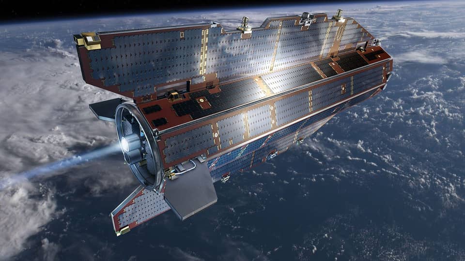
GOCE Satellite Marked a New Chapter in Earth Gravity Mapping
Launched in 2009, the European Space Agency satellite mapped variations in Earth's gravity and studied ocean circulation.
FlyMarshall Newsroom1 min read
Photo: European Space Agency
GOCE launched in 2009 for a mission that measured variations in Earth’s gravity and examined the planet’s interior and ocean currents.
Key details
- GOCE stands for Gravity field and steady-state Ocean Circulation Explorer.
- The satellite used a xenon ion engine to maintain a low orbit.
- Its reported operating altitude was about 224 kilometers.
- GOCE measured about 5.3 meters long and had a reported mass of approximately 1,100 kilograms.
GOCE launched in 2009 to map variations in Earth’s gravity and study ocean circulation.
Why it matters
GOCE’s measurements combined gravity mapping with observations of ocean circulation. Its mission also examined the structure of Earth’s crust and mantle.
More stories
Space
TOI-2535 b's Transits May Disappear for at Least 30 Years
Space
SpaceX Plans Starship Flight 15 for Nov. 13
Space
Study Models Uranus and Neptune's Unusual Magnetic Fields
Space
Caltech-Led ASTRA Robot Builds Part of an Antenna Structure in Orbit
Space
NASA's Curiosity Rover Images Planned Drill Target Nazca
Space